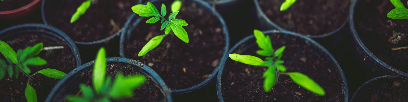
The Climate Atlas allows you to explore how climate change is likely to impact Canada’s agricultural sector.
Hotter temperatures and changes in precipitation may introduce new risks, while a longer growing season with more heat accumulation and fewer frost days may have some benefits. Of course none of these changes is projected to happen in isolation: the positive likelihood of a longer growing season co-exists with possibly damaging changes in patterns of seasonal precipitation and very high heat.
Understanding the magnitude of these various changes and risks allows farmers, citizens, politicians, and planners to take meaningful action to mitigate and adapt.
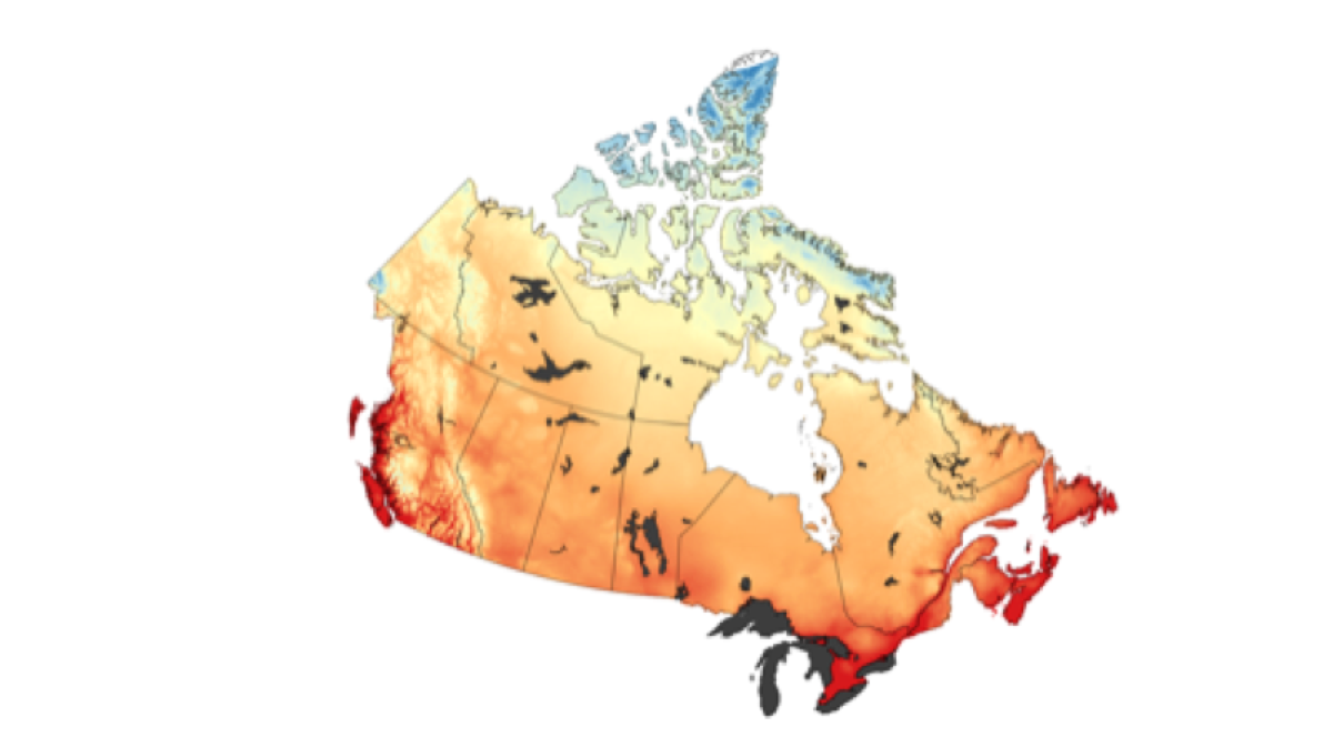
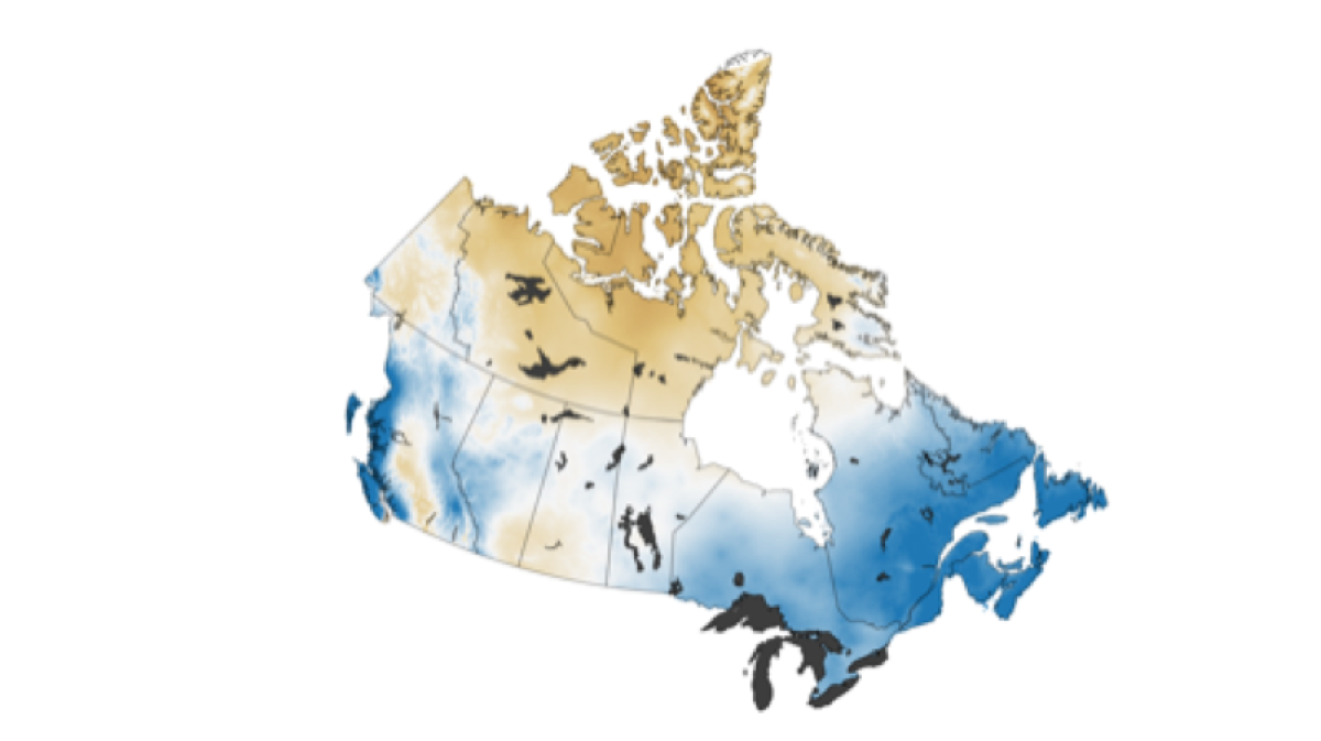
Frost-Free Season
The frost-free season is the number of days between the date of the last spring frost and the date of the first fall frost. The average length of the growing season is an important consideration when selecting or predicting what plants might grow well in a region. A longer frost-free season means plants and crops have a longer window to grow and mature.
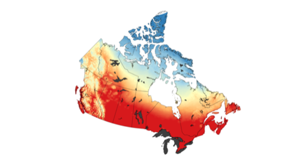
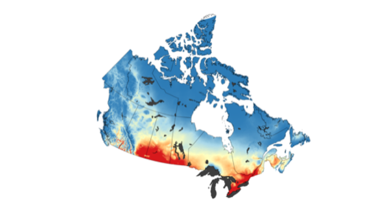
Growing Degree Days
Growing Degree Days (GDD) tell farmers how much heat is available for the growth and maturation of plants and insects. Different base temperatures (5, 10 and 15 °C) are used to capture results for plants and insects that require different amounts of heat.
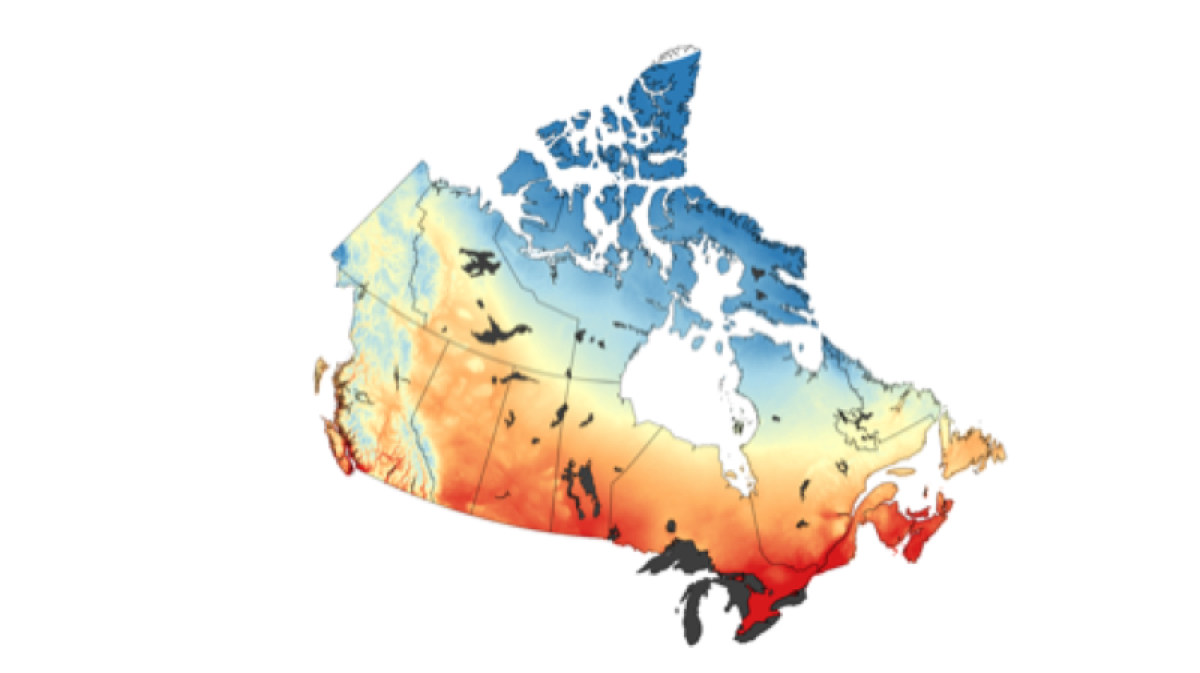
Corn Heat Units
Corn Heat Units are used to estimate whether the climate is warm enough (but not too warm) to grow corn. Very generally, at least 2200 CHUs are required to mature most varieties of corn. Note that this index is only based on temperature and does not consider the availability of water to grow the crop.
Precipitation
Precipitation patterns are critical to agriculture for many reasons, including water availability for crop production, snow cover accumulation, and short- and long-term drought risk. The Atlas provides precipitation data averaged across important agricultural seasons, including the growing season and harvest season.
Very hot days
High, persistent temperatures increase the risk of drought, which can severely impact food production and increases the risk of wildfire. High temperatures can also lead to more thunderstorms, which means increased risks of wildfire, flash flooding, and hail. The Atlas also provides seasonal values for mean and average high / low temperatures, so projected changes in temperature can be explored in considerable detail.
Recommended Article Citation
Climate Atlas of Canada. (n.d.) Climate Change Maps for Agriculture. Prairie Climate Centre. https://climateatlas.ca/climate-change-maps-agriculture


.png)